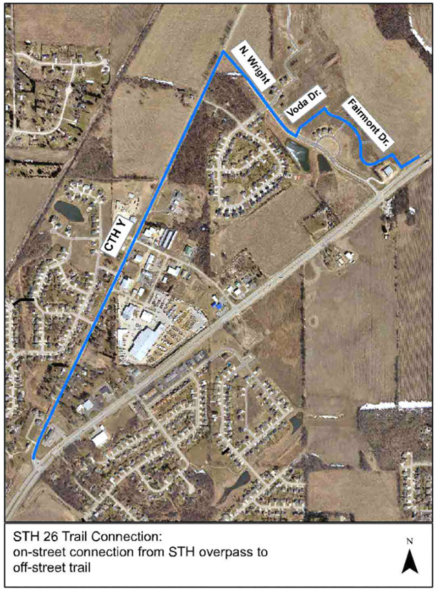
Janesville City Bike Trail Connector
"How the heck do I get to the Milton Trail from Janesville?" is a frequent refrain that we hear!
Below is an aerial view showing the streets needed to get to the trail where it starts near Wright Road and Highway 26. That distance is roughly 1.5 miles.
Please note that County Highway Y is also known as John Paul Road. The southern tip shown is after the bridge that crosses Highway 26 (Milton Ave.) right next to Frank Boucher Chrysler. The other end of the blue line is just east of the Janesville Animal Medical Center.
(You can park in the Pine Tree Plaza and bike the trail from there to the bridge.)